Another Vortex Hits Texas | Extreme Earth
Subtitles
  • Off
  • English

This Week's Surreal Weather Nightmare, in Photos

This Week's Surreal Weather Nightmare, in Photos

A huge portion of the U.S. saw unprecedented December weather, as high winds, dust, and severe thunderstorms spread across the nation.

We may earn a commission from links on this page.
Start Slideshow
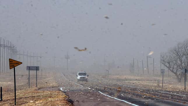
Debris from nearby farm fields swirls around on Highway 400 between Mullinville, Kansas, and Dodge City.
Photo: Travis Heying/The Wichita Eagle (AP)

Wednesday was easily one of the weirdest weather days the U.S. has had in a long time. Despite the calendar showing it’s mid-December, historic warmth gripped the eastern half of the country. When a storm coming from the West met the hot zone, atmospheric sparks flew.

Advertisement

Record winds, bizarre wildfires, plumes of dust and debris, a derecho, and powerful swells on the Great Lakes all conspired to ravage areas from eastern New Mexico to Michigan. “Historic,” “unprecedented,” and “record” are just some of the superlatives the National Weather Service invoked in its forecasts and updates throughout the day to describe what was happening on the ground.

Now, residents are left with the task of cleaning up, joining those in the South who are still reeling from last week’s tornado outbreak.
Advertisement
Previous Slide
Next Slide

2 / 7

The Winds Have Never Been This Bad

The Winds Have Never Been This Bad

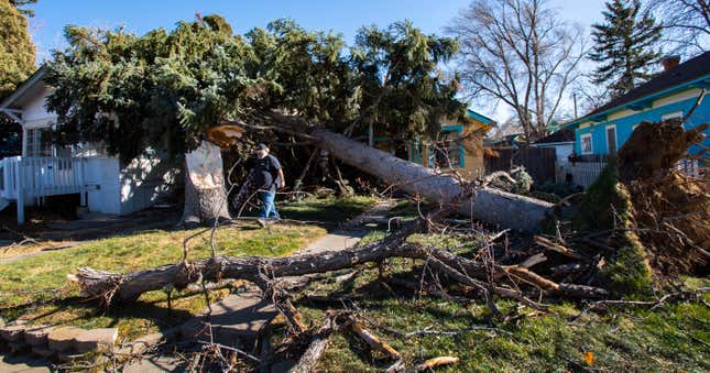
A person walking in front of a tree that fell on a house.
Dorcie Childs walks under two evergreen trees in his Colorado Springs, Colorado, front yard that were blown over in a wind storm.
Photo: Christian Murdock/The Gazette (AP)

The U.S. is no stranger to weather that comes with high winds, from tornadoes to hurricanes to California’s Santa Anas. But what happened on Wednesday is nothing short of historic.

Advertisement

The NWS Storm Prediction Center catalogs the gnarliest weather to hit the U.S., including reports of tornadoes, hail, and high winds. The center received 282 reports from weather stations in eight states for high winds. Among those reports are 55 stations that saw winds crack 75 mph (121 kmh). That sets a record for the most stations reporting winds that intense, one that was set during last August’s derecho. On the scale used to measure hurricanes, that means those stations saw gusts at least as high as a Category 1 storm. This type of storm’s wind profile is a bit different, so it’s not quite an apples-to-apples comparison, but you get the point. Winds bad! And frankly, the damage isn’t so far off from what hurricanes do to structures.

Advertisement
Previous Slide
Next Slide

3 / 7

Dangerous Dust and Wildfires

Dangerous Dust and Wildfires

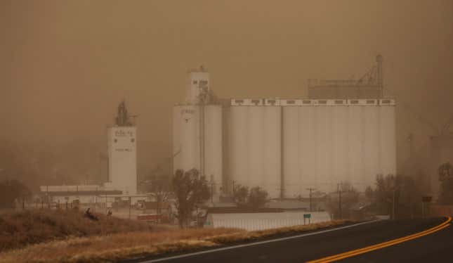
A grain elevator seen through the haze of the dust storm in Jetmore, Kansas.
Visibility was less than a half-mile in Jetmore, Kansas.
Photo: Travis Heying/The Wichita Eagle (AP)

As a front moved through the Plains, it sucked up dust into the sky. That limited visibility, leading large portions of I-70 to be shut down to protect motorists. It wasn’t just dust limiting visibility, though. Smoke from wildfires also clouded the sky. Flames spread across the prairie in Texas, Oklahoma, and Kansas.

Advertisement

The smoke is so plentiful that the NWS Chicago office told residents not to be alarmed if they smelled any. It’s not that the city was on fire, just smoke wafted from 600 miles (965 kilometers) away. Nothing to worry about! Just normal December things!

Advertisement
Previous Slide
Next Slide

4 / 7

A Tornado Touched Down in Minnesota

A Tornado Touched Down in Minnesota

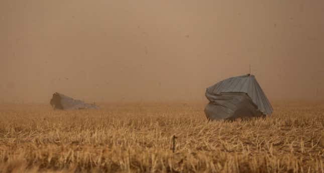
The Hodgeman County Undersheriff confirmed these grain bins were blown away from a nearby farm into cornfield across Hwy 283 in Jetmore, Kansas.
Photo: Travis Heying/The Wichita Eagle (AP)

I feel compelled to once again reiterate, this is a story about weather things happening in December that simply should not be happening in December. Among them is a tornado that touched down in Minnesota near Plainview. The city is in the southeast portion of the state, an area that has up to a 75% chance of having a white Christmas in an average year. In other words, cold is the norm for this time of year. Yet the city now has, for lack of a better word, the “distinction” of recording the first December tornado in Minnesota history.

Advertisement

All told, the Storm Prediction Center received 21 tornado reports on Wednesday. Again, in December.

Advertisement
Previous Slide
Next Slide

5 / 7

The Winds Have Caused Widespread Power Outages

The Winds Have Caused Widespread Power Outages

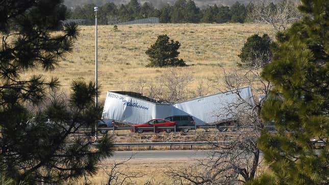
High winds toppled a semi-truck on I-25.
Photo: Jerilee Bennett/The Gazette (AP)

The powerful winds and derecho combined to wreak havoc on the electric grid. In what has become a defining story of the U.S. in 2021, hundreds of thousands of households are without power. More than 550,000 households in areas impacted by yesterday’s windpocalypse have lost power, with the most widespread outages in Michigan. That state alone has nearly 237,000 homes with no juice, most in the Upper Peninsula and northern half of the mitten. (If you’re from Michigan, you know.)

Advertisement

Those folks join the 12,000-plus households in Kentucky still without power following Friday’s deadly tornado outbreak and the millions more who have lost power this year across the country from wildfires, cold, heat, and hurricanes. Just in case you needed a reminder that our 20th-century grid isn’t ready for 21st century weather, this is it.

Advertisement
Previous Slide
Next Slide

6 / 7

More Unsettled Weather Is on the Way

More Unsettled Weather Is on the Way

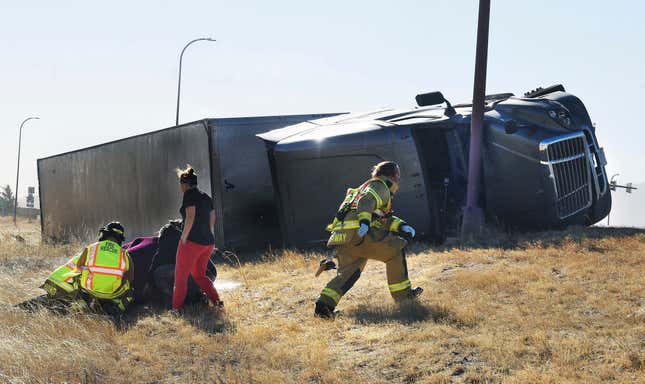
Paramedics tend to an injured person on the onramp of I-25. More than a dozen trucks were blown over by high winds.
Photo: Jerilee Bennett/The Gazette (AP)

While residents are dealing with the aftermath of Wednesday in some places, the storm is still wreaking havoc. Parts of Great Lakes region face a patchwork of weather warnings for high winds and waves and lakeshore flooding. Winds there could reach 75 mph while waves could climb to 19 feet (6 meters) on Thursday.

Advertisement

“Very strong winds will cause hazardous highest waves which could capsize or damage vessels and reduce visibility,” the NWS warned.

It also said that parts of the Upper Peninsula will face pretty serious flooding as a result. “Numerous roads closed and low lying property including parking lots, lawns, and homes and businesses will be inundated near the lake.”

Meanwhile, the West is its own patchwork of winter weather warnings as another system moves into the region with heavy snow. And the Northeast will see potential record high warmth. A Hawaii vacation has never sounded better.

Advertisement