What is happening?
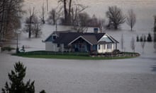
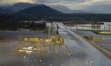
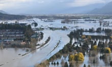
A huge storm dumped record rainfall across swathes of British Columbia in Canada and Washington State in the US between Saturday and Monday.
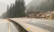
Thousands of people have been forced to leave their homes, others became trapped on cut-off roads, and several towns were completely cut off. Mud and landslides have destroyed parts of major highways. British Columbia’s premier issued a state of emergency on Wednesday and troops have been deployed to help those still stranded.
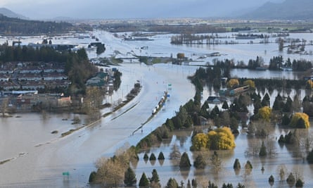
The port of Vancouver, the largest in Canada, was forced to suspend all rail access, and the city itself was all but cut off from the rest of Canada. At least one person has been confirmed dead and others are missing.
In the town of Abbotsford, farmers ignored an evacuation order and desperately tried to save their animals from rising waters, in some cases tying ropes around the necks of cows and pulling them to higher ground.
Why is the flooding so bad?
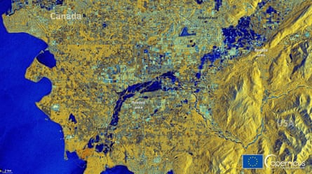
The area has been drenched by unusually heavy rain – what one meteorologist has referred to as a “parade of storms” – since September. More rain fell in Bellingham in Washington State between Saturday and Monday than normally falls there during all of November.
The heavy rainfall is linked to an atmospheric river, a narrow corridor of concentrated moisture in the atmosphere. Hurricane scientist Jeff Masters has described the phenomenon as like “a river in the sky that acts like a pipe transporting huge amounts of water vapour out of the tropics”.
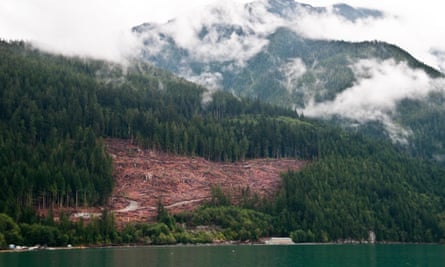
The flooding has been exacerbated by clearcut logging and its effect on slope stability, the rate at which water is absorbed into the ground and the ability to hold soil in root systems. Without trees, heavy rains can wash large amounts of sediment into nearby water systems, choking creeks and streams and causing them to quickly overflow.
The risk of landslides and debris flow has also been heightened by summer wildfires in the region. “There’s a very clear link between a wildfire happening and the risk of a landslide or debris flow,” Thomas Martin, a forester in the province, said on Tuesday. “If you burn a lot of the trees, grass and shrubs, there are fewer living things to intercept the water. It just flows directly off the hill. And fires can make the soil hydrophobic so the runoff increases even more.”
What happened in the region in the summer?
The storm is battering the same region that five months ago suffered an extreme heatwave, fuelling destructive wildfires. In June the small mountain town of Lytton registered a temperature of 49.6C (121F), obliterating Canada’s national heat record.
Police stations and hospitals reported a surge in heat-related deaths – 595 in British Columbia, and dozens more south of the border. Roads buckled as asphalt expanded. At least one city suffered power cuts.
The extreme weather was caused by an extended “heat dome” parked over the Pacific north-west. Although not an official term, a “heat dome” is created when high pressure in the upper atmosphere acts as a sort of lid, preventing hot air from escaping. Combined with high temperatures, this causes hot air to sink to the surface, causing further warming as it descends.
How is the situation linked to the climate crisis?
Scientists who analysed the regional heatwave found that human-caused climate change made the extreme weather at least 150 times more likely. Referring to both the heatwave and the storms, Joe Boomgard-Zagrodnik, an agricultural meteorologist at Washington State University, told NBC this week: “We were super hot and dry in the summer, and the switch flips. It definitely matches what the climate models show for the future around here – hotter, drier summers and wetter winters.”
As the climate warms scientists expect atmospheric rivers to form in more rapid succession, grow more intense, and become longer, wetter and wider. According to Environment Canada, there have been five atmospheric rivers already this season, which is highly unusual.
The way in which the summer fires exacerbated the winter flooding is an example of a compound climate disaster.

