September 28, 2022 Hurricane Ian updates

By Adrienne Vogt, Elise Hammond, Aditi Sangal, Mike Hayes, Maureen Chowdhury, Seán Federico-O'Murchú and Meg Wagner, CNN

Updated 1:52 a.m. ET, September 29, 2022
127 Posts
Sort byDropdown arrow
8:24 p.m. ET, September 28, 2022

Aerospace engineer has flown through 22 storms. Ian was the "roughest flight he's been on"

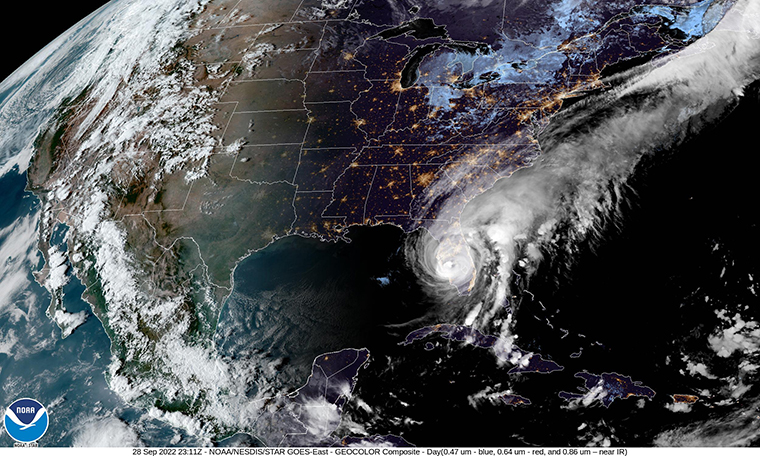
The aerospace engineer who flew through Hurricane Ian on Wednesday morning said it was the "roughest flight" he's been on — and that's after flying 76 times through 22 storms.

"Out of all of those, that was absolutely the worst," Nick Underwood said.

Underwood works with the National Oceanic and Atmospheric Administration to study these major weather events, up close and personal. The crew flies into a hurricane and out the other side.

He told CNN that Ian was strengthening to a Category 4 just as the crew was flying through the storm.

"There was a ton of turbulence, both up and down," he said. "The lateral turbulence, which is honestly the most unsettling part of it — it was something else."

Though every storm is different, the turbulence and the amount of lightning were what set apart Hurricane Ian.

"We were flying through at night, but once we got into the eye, I was taking photos like it was daytime because there was just so much lightning outside," Underwood said. "It's really just those simple factors that really contribute to these storms growing in size. That ocean temperature, the low wind sheer, those kinds of things."

Watch the video from inside the aircraft:

8:04 p.m. ET, September 28, 2022

Storm surge has been up to 12 feet in some areas of Florida, governor says

From CNN’s Jamiel Lynch

The storm surge from Hurricane Ian has reached up to 12 feet in some areas, Florida Gov. Ron DeSantis said in a news conference on Wednesday. 

“In some areas, we think it’s hit 12 feet. It is our meteorologist’s view that the storm surge has likely peaked and will be less in the coming hours,” he said. 

DeSantis said there could be hurricane-force winds in central Florida before the storm exits the state. 

“I think at landfall it’s going to be behind only the Labor Day Hurricane, Hurricane Andrew and Hurricane Michael in terms of intensity,” he added. 

DeSantis said that Hurricane Ian, at minimum, will be a very strong Category 4 hurricane that ranks as one of the top five to hit the Florida peninsula.

7:49 p.m. ET, September 28, 2022

Extreme wind warning issued for Central Florida as Hurricane Ian approaches

From CNN's Gene Norman

An extreme wind warning is in effect for these Central Florida cities — Sebring, Avon Park and Arcadia — until 9:30 p.m. ET as Ian approaches. 

The National Weather Service in Tampa advises that residents to “treat these imminent extreme winds as if a tornado was approaching and move immediately to an interior room or shelter now!”
7:22 p.m. ET, September 28, 2022

Hurricane Ian weakens to a Category 3

From CNN's Dave Hennen

(NOAA)
(NOAA)

Hurricane Ian has weakened to a Category 3 storm with maximum sustained winds of 125 mph, according to the 7 p.m. ET update from the National Hurricane Center. 

The storm is expected to weaken further as it continues to push further inland in Florida. Still, dangerous winds gusts of more than 100 mph have recently been reported.

7:21 p.m. ET, September 28, 2022

Key West International Airport will reopen Thursday morning

From CNN’s Jamiel Lynch

Key West International Airport is set to reopen Thursday at 7 a.m. ET, according to its website.

Airport crews will work throughout the night to prepare the airport to reopen, Richard Strickland, director of airports, said in a Facebook post.

The airport closed to all inbound and outbound traffic on Tuesday due to Hurricane Ian.

7:15 p.m. ET, September 28, 2022

These are the Florida counties reporting power outages so far

From CNN's Virginia Langmaid

The state of Florida has surpassed 1.5 million customers without power, according to PowerOutage.us

Seven counties are reporting more than 50% of tracked customers as without power.

  • Lee county: 447,132 outages, 95% of tracked customers
  • Sarasota county: 232,710 outages, 81% of tracked customers
  • Collier county: 184,183 outages, 70% of tracked customers
  • Charlotte county: 124,738 outages, 98% of tracked customers 
  • Manatee county: 123,241 outages, 52% of tracked customers
  • Desoto county: 17,368 outages, 93% of tracked customers
  • Hardee county: 6,717 outages, 70% of tracked customers

In addition, 10 more counties are reporting more than 10,000 customers without power.

  • Pinellas county: 152,327 outages
  • Polk County: 43,257 outages
  • Miami-Dade county: 32,270 outages 
  • Hillsborough county: 31,447 outages
  • Highlands county: 17,951 outages
  • Volusia county: 16,764 outages
  • Palm Beach county: 15,160 outages
  • Orange county: 14,563 outages 
  • Pasco county: 13,701 outages
  • Broward county: 11,982 outages

You can track outages here.

7:19 p.m. ET, September 28, 2022

Here are some of the highest wind gusts reported in southwest Florida as Hurricane Ian struck

From CNN's Gene Norman

High wind gusts and storm surges are being reported as Hurricane Ian moves across Florida. Here are some of the highest winds reported in southwest Florida, according to the National Weather Service:

  • Cape Coral – 140 mph
  • Punta Gorda – 124 mph
  • Grove City – 110 mph
  • Sarasota – 106 mph
  • Venice – 104 mph
  • Fort Myers – 100 mph

The National Weather Service in Tampa notes that some of the automatic reporting stations are broken or are not reporting due to communications failure.

7:14 p.m. ET, September 28, 2022

Tampa mayor warns residents the worst is yet to come

From CNN’s Paradise Afshar

Tampa Mayor Jane Castor is urging residents to shelter in place as the worst of Hurricane Ian is yet to come to the metropolitan area. 

“There has been somewhat of a lull especially since Hurricane Ian made landfall down in South Florida, so there may be the idea that we’ve been through the worst of it, it is yet to come for Tampa Bay,” she said. “So we’re asking everyone to shelter in place.” 

Castor said there have a number of trees down in the community and roughly 5,000 residents without electricity. First responders, including some ambulance services, have also pulled their crews due to weather. 

“We are expecting that we’re going to get the majority of the rain and the higher winds starting about 8 p.m. and they’re going to last throughout the night,” she said. “We are still expecting widespread flooding throughout our city, and anywhere from tropical storm wind speeds to the possibly of category one hurricane wind speeds.” 

Tampa Fire Rescue Chief Barbara Tripp echoed that message and said residents should be off the roads as the storm is expected to intensify. 

Castor added that officials expect flooding sometime in the next 24 hours. 

“We’re going to see the continued rain, the rain will increase dramatically and then that water is going to come back into the Bay as Hurricane Ian continues its northeasterly trajectory," she said.


7:11 p.m. ET, September 28, 2022

Boil water notice and curfew in effect for Lee County

From CNN’s Amy Simonson

Lee County, Florida, which includes the cities of Fort Myers and Cape Coral, put a curfew and boil notice into place following Hurricane Ian.

The curfew went into effect at 6 p.m. ET Wednesday and will stay in place "until further notice," the county said in a statement.

“This includes unincorporated Lee County and all cities with the exception of Estero at this time. It is critical to shelter in place,” the statement said. 

 Lee County Utilities has also issued a system-wide Boil Water Notice for all customers effective immediately.

“All water used for drinking, cooking, making ice, brushing teeth or washing dishes must be boiled at a rolling boil for one minute. Or, as an alternative, bottled water may be used,” officials said in a statement Wednesday.