
Agatha was downgraded to a tropical storm late Monday after making landfall in southern Mexico as a Category 2 hurricane.
The storm had maximum sustained winds of 70 mph with some higher gusts, the National Hurricane Center said.
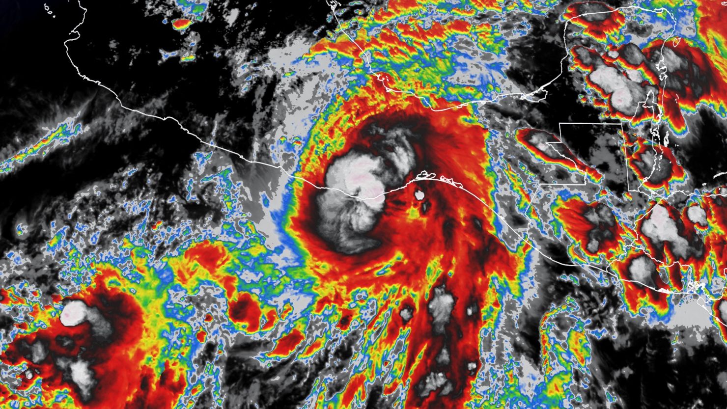
Agatha made landfall Monday afternoon, just west of Puerto Angel, packing 105 mph winds, according to the hurricane center.
All hurricane warnings were discontinued, but tropical storm warnings remained in place from Puerto Escondido to Salina Cruz.
Agatha, the first hurricane of the eastern Pacific season, had rapidly intensified in the eastern Pacific Ocean and was nearing major hurricane status as it approached the southern Mexican coast Sunday night.
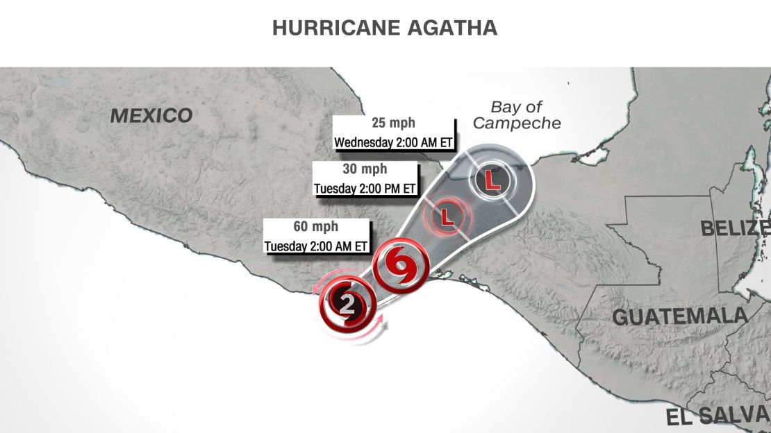
The storm is expected to continue weakening and dissipate by Tuesday afternoon, but “could produce life-threatening flash flooding and mudslides over southern Mexico through Tuesday,” the hurricane center said.
The heaviest rain was set to fall in the state of Oaxaca, where up to 16 inches was forecast, with isolated areas of 20 inches possible.
The remnants of Agatha are expected to head out into the Caribbean Sea and are now at a 50% chance of redevelopment in the next 5 days.
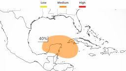
Agatha’s remnants may contribute to the gradual development of a tropical system in the “far southwest Gulf of Mexico around mid-week or in the northwest Caribbean by the latter part of this week,” according to the National Hurricane Center’s Atlantic Tropical Weather Outlook. “Regardless of development, locally heavy rains will be possible across southern Mexico, the Yucatan Peninsula, Guatemala, and Belize through the week,” the center said.
CNN’s Monica Garrett and Robert Shackelford contributed to this report.